
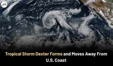
Tropical Storm Dexter Forms and Moves Away From U.S. Coast
Tropical Storm Dexter officially formed late Sunday night over the Atlantic Ocean, several hundred miles off the coast of North Carolina. With sustained winds around 45 mph, Dexter became the fourth named storm of the 2025 Atlantic hurricane season. The storm is tracking east-northeast at about 12 to 14 mph and is expected to stay far offshore. No coastal warnings or watches have been issued, and the system poses no immediate threat to land.
TROPICAL UPDATE: Right now I'm tracking Dexter and two other official areas from the NHC. Next names are #Erin and #Fernand. Here are some thoughts as of Monday evening:
— Matt Devitt (@MattDevittWX) August 4, 2025
1. Dexter formed last night, becoming the 4th named storm of the season. No Miami this time, but it's… pic.twitter.com/5h3VsfTF39
The Broader Significance of Dexter’s Formation
While Dexter isn’t expected to impact the U.S. directly, its arrival is a signal that the Atlantic is becoming more active — and that's exactly what forecasters predicted. The middle of August to early September is traditionally the most intense part of the season, and Dexter seems to be kicking that off.
Here’s what really matters:
-
Forecasts have called for a busier-than-average hurricane season, and this development fits that pattern.
-
Even without landfall, offshore storms like Dexter can stir up dangerous surf and rip currents all along the East Coast.
-
The presence of multiple disturbances in the Atlantic suggests that more activity may follow soon, including potentially stronger or more impactful storms.
MORE ARTICLES:
Underlying Concerns and Overlooked Developments
Beyond the headlines, there are other systems in play that aren’t getting as much attention. A low-pressure area near the Southeast U.S. coast — off Georgia and Florida — is being closely monitored. While it’s not a named storm yet, it’s carrying the potential to bring heavy rain, gusty winds, and localized flooding.
Meanwhile, another tropical wave is emerging from the West African coast and could develop in the coming days. It’s sitting in a region known for generating major storms during this time of year. On top of that, ocean temperatures across much of the Atlantic are well above average, which helps fuel rapid storm development.
These quiet signals suggest that the current lull in direct threats may not last long.
What to Expect in the Coming Days
Dexter is forecast to weaken and eventually become a post-tropical system by midweek. Although it’s heading away from land, its effects may still be felt indirectly. Swells and rip currents are expected to increase along beaches from the Northeast down to Florida, so beachgoers should stay cautious.
The disturbance near the Southeast could develop further or remain disorganized. Either way, it could dump significant rainfall over parts of Georgia, Florida, and the Carolinas. And the tropical wave from Africa? That could eventually reach the Caribbean or Atlantic islands, depending on how it evolves.
This is the time of year when quiet weather can shift quickly — so even storms that seem far away deserve close attention.
Final Thoughts and What Comes Next
Dexter may not be a storm that makes headlines for destruction, but it’s a wake-up call that the most active stretch of hurricane season is now underway. Several systems are already brewing, and warm waters plus favorable wind patterns make further development likely.
Looking ahead, the focus will be on how these emerging systems develop and whether any take aim at land. The next few weeks will be critical, and staying informed is key — especially for those living along the coast or planning travel to beach destinations.