
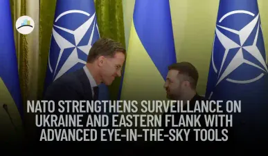
NATO is deploying a broad set of advanced surveillance capabilities—including space, air, sea, and land sensors—to strengthen monitoring of military activities in Ukraine and along its eastern frontier. These new tools aim to provide near real-time situational awareness against Russian aggression, reassure vulnerable member states, and support Kyiv’s defense effort.
This multi-layered initiative marks a significant upgrade in NATO’s intelligence, surveillance, and reconnaissance (ISR) posture. From sophisticated satellite imagery to airborne radar platforms and ground radar installations, the alliance is closing intelligence gaps and reinforcing deterrence across eastern Europe.
Satellite Surveillance: A Clear View from Above
NATO has tapped into private-sector assets like Finland’s ICEYE satellite constellation, providing near real-time Synthetic Aperture Radar imagery that works in any weather or light conditions. These satellites deliver continuous ground monitoring, allowing NATO analysts to detect troop buildups and equipment movement—even in cloudy or night-time scenarios.
Read More on Procapitas:
Europe’s broader push for satellite-based independence also supports this, complementing NATO’s own space-based ISR systems and providing backup during contested scenarios where resilience is critical.
Airborne EW and Radar: AWACS and Beyond
NATO’s fleet of AWACS (Airborne Warning and Control System) aircraft, typically based in Germany and France, has increased routine patrols over Romania, Poland, and the Black Sea. Their rotating domes and advanced electronic surveillance systems provide real-time detection of aircraft, drones, missiles, and ships.
These missions double as deterrence: the constant AWACS presence signals NATO’s capability and readiness right at the front line. Allied fighter jets continue to escort and support these flights during large exercises like Astral Knight, underscoring integrated air defence coordination.
Drone Wall and Maritime Surveillance
A new “drone wall” concept is underway—a network of AI-powered reconnaissance drones, ground sensors, and counter-drone systems spanning from Norway through the Baltics to Poland. This mobile aerial shield can detect low-level threats such as unmanned aircraft and illegal crossings, feeding data into a shared situational awareness framework.
In parallel, maritime drones and coastal sensors are being deployed in the Baltic and Black Sea regions to monitor naval activity, intercept Russian drones, and track seaborne threats near Ukraine’s coastline.
Ground Radar and Sensor Grids
To fill remaining blind spots, NATO has installed new radar and sensors along key overland routes. These systems, including mobile ground radars and electronic warfare sensors, are strategically placed to detect low-altitude incursions and short-range missile launches.
They integrate with mobile command centres and air defence systems—allowing frontline states and NATO Response Force units to coordinate faster in case of emergency.
Alliance Ground Surveillance Force Integration
NATO’s Alliance Ground Surveillance (AGS) Force, operating RQ-4D Phoenix drones, has increased sorties over eastern Europe since 2022. Based in Italy and controlled from Germany and Belgium, this network enhances border monitoring, maritime oversight, and signals intelligence collection.
These RPAs (remotely piloted aircraft) can remain aloft for long durations, covering thousands of square kilometres with high-resolution radar feeds—bolstering early-warning and battlefield mapping capabilities.
Strategic Drivers and Political Context
The surveillance upgrade responds directly to concerns raised by the “Bucharest Nine” and other eastern alliance members, who insist on beefed-up NATO presence and reassurance ahead of the July Vilnius summit.
These monitoring capabilities support NATO’s broader eastern flank strategy: from permanent battlegroups in the Baltics to mobile anti-air systems and reinforced intelligence sharing with Ukraine. Together, these layers form a multidomain shield designed to deter Russian aggression and reinforce alliance cohesion.
Supporting Ukraine with Allied Intelligence
NATO now routinely shares intelligence feeds with Kyiv, integrating satellite imagery, AWACS coverage, AGS drone data, and ground sensor inputs into Ukrainian battlefield management systems. This enhances Ukraine’s ability to anticipate Russian operations, position air defences, and plan tactical responses.
This integration underscores NATO’s commitment to Ukraine’s defence—even as full membership remains distant—by investing in real-time cooperation rather than merely symbolic gestures.
What’s Next
-
Full deployment of satellite constellations, drone patrols, ground sensors, and AWACS operations is expected by early 2026.
-
The upcoming Vilnius summit will likely expand funding and coordination under NATO’s modernization and European defence capacity initiatives.
-
Common exercises and simulations (e.g., Astral Knight) will test and refine sharing and response protocols across NATO and Ukraine.
-
Response readiness will extend to hybrid and cyber threats—countering GPS interference, sabotage, and drone incursions in border areas.