
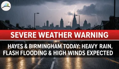
Weather Update: Heavy Rainfall Expected in Hayes and Birmingham, UK
As the weather patterns shift across the UK today, residents of Hayes and Birmingham should brace themselves for an unusually wet and chilly day. Both cities are experiencing persistent rainfall, with warnings of severe weather conditions, including flooding in some areas. Here’s everything you need to know about today’s weather, the severe rainfall warnings, and some key weather details such as sunrise timings.
MORE ARTICLES:
Hayes: Light Rain and Cloudy Skies
In Hayes, located in the western suburbs of London, the weather has started off with light rain and temperatures hovering around 13°C (55°F). This is expected to continue through the morning with periods of drizzle and showers, making it a rather damp and chilly start to the day. By midday, the temperature will rise slightly to 14°C (57°F), but the clouds will remain, and occasional rain showers will persist throughout the day.
If you plan on heading out, it's best to carry an umbrella or wear a waterproof jacket as the light rain will continue until late in the evening. Despite the overcast skies and cooler temperatures, Hayes won't experience the severe conditions seen in some other parts of the country today. However, the damp weather can still make roads slippery, so caution is advised for anyone traveling during the day.
Birmingham: A Wet and Cold Day with Severe Weather Warning
The weather in Birmingham today is significantly worse. The city is facing a persistent rainfall scenario, with temperatures remaining between 9°C (48°F) and 10°C (50°F) throughout the day. The light rain, which started early this morning, is expected to intensify as the day progresses, turning into heavier showers by the afternoon. The temperature will remain chilly, and the combination of rain and cold will make it feel much colder outside.
In addition to the regular rainfall, the West Midlands region, including Birmingham, is under an Amber Severe Weather Warning due to the arrival of Storm Claudia. The Met Office has issued warnings for heavy rainfall throughout the day, with some areas expecting up to 80mm of rain. Flooding is likely, especially in low-lying areas and regions near rivers and streams.
Travel disruptions are expected, including delays and cancellations in both bus and train services. Roads may become hazardous, and local authorities are advising people to avoid non-essential travel. There’s also a risk of power outages in affected areas due to the intensity of the storm. If you're in Birmingham, it's essential to stay informed through local news updates and follow the advice from emergency services to stay safe.
Severe Rainfall Warning: What to Expect
For those in the West Midlands, particularly Birmingham, an Amber Warning has been issued due to Storm Claudia, which is expected to bring prolonged, heavy rainfall. From 12:00 PM GMT until the early hours of Saturday, the region will experience significant rainfall, and there is an increased risk of flooding, especially along roads and low-lying areas.
What to Expect:
-
Heavy rain: 40-60 mm expected across most of the region, with some places seeing up to 80 mm of rainfall.
-
Flooding: There is a risk of flooding, particularly along roads, and some communities may become cut off.
-
Travel disruptions: Expect delays in bus and train services, and difficult driving conditions.
-
Power outages: Some homes and businesses may face power cuts and disruptions to services.
-
Danger to life: Floodwater could be fast-flowing and deep, posing risks to personal safety.
What You Should Do:
-
If possible, avoid traveling during the peak of the storm. If you must travel, ensure you check road conditions before leaving and exercise extreme caution.
-
Keep an emergency kit with essentials such as a torch, first aid supplies, and waterproof clothing.
-
Keep a close eye on vulnerable individuals—particularly the elderly and those living alone—who may need assistance during the storm.
Sunrise Today: A Glimpse of Light Amid the Rain
Despite the persistent rain and overcast skies, today’s sunrise in the UK occurred at approximately 7:00 AM in both Hayes and Birmingham. However, with the clouds hanging low, sunlight was minimal, and the daylight felt a little later than usual. The weather forecast predicts that, while there may be breaks in the rain throughout the day, the clouds will continue to dominate the sky, and the chances of seeing any clear skies remain slim.
What Should You Do Today?
Given the weather conditions, it’s best to stay informed and prepared. Here’s what you can do:
-
For Hayes: Although not as severe, Hayes will still see consistent rainfall, so it’s advisable to carry an umbrella if you’re heading out. A waterproof jacket will also help, as rain showers are expected to continue into the evening.
-
For Birmingham: The situation in Birmingham is much more serious. As the severe weather warning suggests, try to avoid travel if possible, particularly after noon when the rain will intensify. Stay home, stay safe, and if you must go out, be prepared for possible flooding and reduced visibility on the roads.
In both cities, staying warm and dry should be a priority. If you live in an area prone to flooding, it’s a good idea to prepare for possible disruptions and check on any loved ones who may need assistance.
Final Thoughts
Today’s weather in Hayes and Birmingham brings rain and chilly temperatures, but Birmingham is facing more severe weather due to Storm Claudia. With flooding expected, it’s crucial to take the necessary precautions and remain informed. Whether in Hayes or Birmingham, be sure to check the weather frequently and follow local advice to ensure your safety throughout the day. Stay safe, stay dry, and take care on the roads.